
Peru Trek- 2017: Adventure to Choquequirau
Looking for a more remote trek and site visit with just your group and maybe 10 - 15 other trekkers instead of literally 1000’s of others? You’ve found the one to do!
This trek is 46 miles round trip with most of it on narrow, but solid trail and virtually no way to get lost. In addition to the length of the trek, you will do roughly 4 vertical miles! You can easily do this one unsupported and there is really no need for a tour guide. Despite the ease of navigation, make no mistake…this is a tough, challenging hike.
Days 1- 3: Getting to the trailhead: Unless you are already living at relatively high elevation, you will need several days acclimation once you arrive in the region prior to your trek in order to acclimate and avoid altitude sickness. Best plan seem to be to find your way to Cusco, Peru and spend 2 days there before heading for the trail. Coming from the states, Day #1 was simply all travel, and we arrived in Lima in the early evening and then checked into the Wyndham Costa Del Sol Lima Airport (basically right at the airport. Super convenient - basically right in the airport compound. On Day #2, we caught an early morning flight to Cusco and stayed there for two nights.
Day #4: Find your way to Cachora. It’s nearly a 4 hour drive and there are multiple options to get there, ranging from a bus, to collectivo or private taxi. We took a cab to Cachora, which frankly was in retrospect, the biggest mistake or problem we had on the trip - because the driver pretty much scammed us with the fee, stopping about an hour of town and claiming he misunderstood the destination and needed to either charge nearly double or return us to Cusco. We paid up and proceeded on! Dumped out on a small road in Cachora, we loaded our packs and headed on the trail down. We stayed at Casa de Salcantay in Cachora the night before we hit the trail. Awesome views. Great meal prepared by the owners and an opportunity to visit with them and get some advice for the trek itself.

We got dropped off here on the side of the road
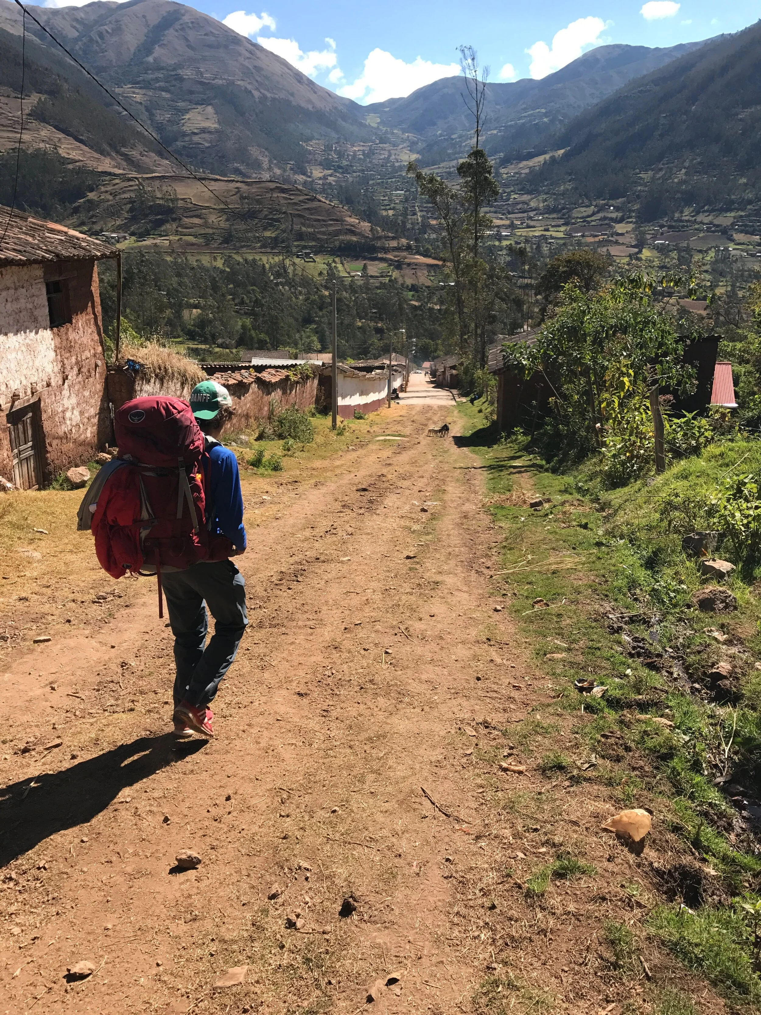
Hiking into Cachora
Day #5: Finally, the trek begins! Leaving Casa de Salcantay, we headed out on dirt roads, through a rural country side setting past homes, farms and small villages, slowly gaining elevation. In the distance we could see the high snow capped peaks of Mt. Salcantay (picture on the right - elevation of 20,574 - never been climbed according to our host,Jan Willem van Delft) and way down in the valley, the shimmering reflection of the Apurima River that we would end up crossing much later in the day after making a very steep descent into the valley. Eventually we arrived at the last stop outpost at Capuliyoc, before the road ended and the actual trail began.
To lighten the load (literally…) we hired a local man as support to “drive” two donkeys that carried our main gear and rented tents. He was a gracious companion along the way, shared some of his life and information on the trail, and as a bonus, set up and tore down our tents each day. This left us only needing to carry our water and food for the day. Nice.


Campsite #1 - Santa Rosa Alta: After trekking for most of they day, we took at break at Chiquisca, which is a campsite roughly a mile or so above the river, as you descend into the valley. Our guide provided some counsel in terms of asking if we were up to continue on to the other side and then begin the ascent towards Choquoquierau, with the benefits being we could be closer to our destination and lessen the amount of the grueling climb that would begin the next day. Why not!? So we proceeded on bravely (foolishly I wonder?). As it turns out, definitely worth it since the next day climb was indeed a major challenge and it was good to get some of it behind us. This campsite is carved into the hillside with the area to pitch a tent a narrow swath of dirt and grass adjacent to some small buildings and covered shelter where we were able to cook our food close-by. There is a rustic bathroom and running water, as well as a small store (really just a hut) where the owners of the camp sell provisions (small food items, beer). Not fancy, but a fine enough place to rest as we passed through.


Day #6: Campsite #2 - Marampata: Our second day, we awoke rested (like who wouldn’t after that challenging hike (little did we know what lay ahead of us!). This day was pretty much an uphill grind and we didn’t arrive at Marampata until late in the afternoon. The campsite is very basic, but nice level setting for our tents, bathroom facilities - shower and toilet were fine (kindof open air, but fine just the same). The best part of this site I think was the family who owns it and the ability to buy a hot meal. It was a real treat, mainly of rice and some type of pumpkin-like vegetable with a fried egg on top. We were hungry. It was delicious. Running around on the dirt floor kitchen where the cooking was done, we had the option to select a guinea pig for dinner. Passed on that - but was fun to consider.

Day #7: The ruins - Choquequirao; The ruins are…well…ruins! The buildings are few, some of which have been reconstructed. It was truly amazing to reach this destination and think it had been a thriving village at some time. A big benefit of visiting this site compared to Machuu Pichu is that we had it nearly to ourselves. There were only a few other people there at the time and we were able to walk around uninterrupted. Fantastic. The site itself that has been recovered from the jungle is actually quite small, so it one doesn’t need a great deal of time to see all of it, though lingering awhile is recommended in order to take it all in. We didn’t venture down to the llama terraces that are supposedly worthy of the visit - and our only reason why is out of concern to have to come back up prior to descending. Between the elevation itself and the grueling nature of the hike just to get there, we felt a need to preserve our legs for the journey ahead when we left.


Amazingly, after being there for a few hours we departed to head back down..and then back up the trail. In retrospect, it was literally the hardest trek we’ve ever done. We descended the trail (a vertical mile in descent) and then after crossing the river, began our slow ascent back on unending switchbacks up to the beginning of the trail. Well we didn’t make it all the way back to Casa de Salcantay, but we did manage to arrive at Capuliyoc by the end of the day. At that post, the family gave us an option to pitch our tents at their normal campsite close by, or if we wanted, to pitch them on a covered deck on the back of their house! Unique to be sure, and that is what we did.

We enjoyed a celebratory dinner that we bought from them and also HUGE beers that went down smoothly after the day’s long trek.
Day #8: The return to Casa de Salcantay: The next morning and the trek out that followed was peaceful and uneventful. After the prior day’s trek up the mountain, we were all pretty tired and the pace was slow. Arriving at Casa de Salcantay, we were treated by being able to take showers and then Jan’s wife fed us a great meal of chicken soup (I think the chickens were running around the yard earlier in the day!) after which we climbed into an old van and a friend of Jan’s drove us to our next destination.