
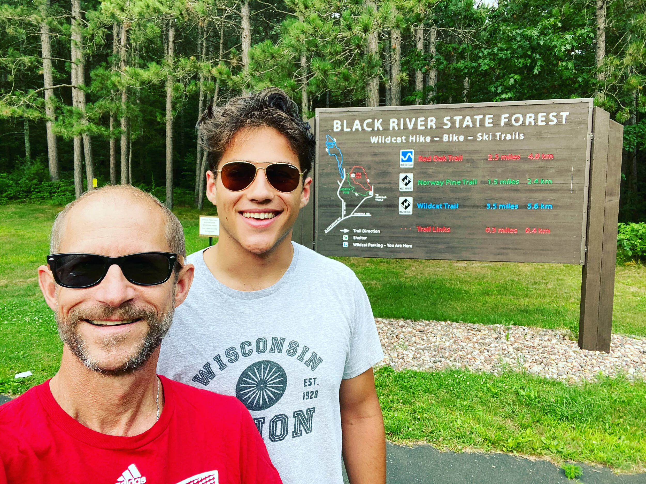
Black River State Forest
No Permit - No Problem!
Primitive Camping in Wisconsin
Date of Trek: July 24 - 26, 2020

All Wisconsin State Forests allow for primitive camping provided you follow a few, very simple rules. Campsites must be at least one mile from a road and 100 feet from a trail or water source, register your stay and vehicle with the State DNR, and practice leave-no-trace. Extra bonus to all….you can have a campfire anywhere with the proviso that you don’t cut down any trees, but just use whatever you find on the ground!
With the COVID Pandemic still in full swing and only a few days available to fit in a trek, we basically looked at options within a 4 hour drive from our home - and selected this state park as the destination since we wanted to avoid a regular campground and get a little space from others in the woods.
Logistics / Stats

If you live in Wisconsin, you can get to this park within a 4 hour drive from anywhere in the state. There are some airports closely: LaCrosse Regional (approx. 1 hour drive), Madison Regional (approx. 2 hour drive) or Mitchell Airport in Milwaukee (3 hours, 15 minutes), though candidly, if you are going to need to fly here…I think there are much better locations to head to versus this state park.
The parking lot and trail head is super easy to find. After loading up our packs, we headed out around 5:30 on Norway Pine Trail towards Wild Cat Mountain - our destination for the night. The trail itself is pretty wide, maybe 10 -15 cut through the woods. For Wisconsin, you pick up a bit of elevation right off the trailhead, but nothing technical or all that difficult.


“High” of the trek = Campsite #1: Just about 2 1/4 miles in, there is a sign “Scenic Lookout” that bears to the right. Strongly recommend you take it - leading to what is a great campsite at the end of the trail, maybe a quarter mile in. Plenty of room to pitch one, maybe two tents, as well as set up a campfire. While heavily wooded in the area, the campsite has some drop-off with solid views to the south and north, as well as a few good options for hammocks.
We pitched our tent but ended up sleeping in our hammocks. Super fun with just enough breeze to keep the mosquitos away.


“Low” of the trek - Water “Fail”: This was the low of our trip! The map of the trail clearly shows a water source (river) that the trail crosses around the 3 mile mark from the trail head. Guess what? No river. Not even signs of where a stream would have been! Since we had planned on filtering our water to replenish, this resulted in the need to hike back to the trailhead, about 4 miles instead of backtracking - where the park information indicated there was a water source. Normally not a big deal, though as luck would have it, our trip was on literally the hottest and most humid day of the summer so far, and with less than a liter a piece, this distracted from the fun as we needed to hydrate. Back at the trailhead, we connected with two other groups and inquired if they had spotted the river. Nope. No river sightings at all. Feels like the map needs to be redone.
As a result of the water challenge and heat, we were pretty cashed out by the time we got to the trailhead. Here’s where we could have had “Water Fail #2” if we hadn’t had our filtration system. So there’s a water source - pump it yourself from the well. Challenge is, the water isn’t clear by any measure. It comes out full of rust and sediment - not cool and clear as what might be expected.